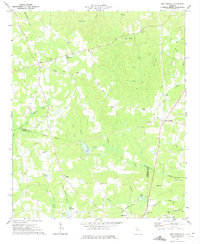
1973 Map of New Georgia
USGS Topo · Published 1975About this map
New Georgia and the surrounding woodlands of Paulding and Carroll counties are mapped here during a period of steady rural development in the early 1970s. The landscape is defined by the headwaters of the Little Tallapoosa River and numerous tributaries such as Sweetwater Creek and Pumpkinvine Creek, which carve through the terrain. A strong network of local institutions is evident through the many community landmarks, including White Oak Springs Ch, Harmony Grove Ch, and Wesley Chapel. The southern portion of the map touches the northern edge of Villa Rica, showing the transition from the town center to the outlying areas like Stockmar and Highpoint. Evidence of earlier land use is visible at the abandoned airport and along the Old Railroad Grade Road, while the sprawling Hannah Crider Swamp indicates the persistent wet lowlands that have historically influenced road placement and agricultural patterns in this part of Georgia.
Find a feature on this map
49 named features on this map. Tap any name to fly to it.
Don’t see what you’re looking for? This feature index may not catch every label — zoom into the map to look around manually.
Map Details
Editions of this 1973 New Georgia Map
2 editions found
Other maps of this area

1889 · Tallapoosa
USGS Topo · 1:125,000

1891 · Marietta
USGS Topo · 1:125,000

1892 · Tallapoosa
USGS Topo · 1:125,000

1895 · Marietta
USGS Topo · 1:125,000

1897 · Marietta
USGS Topo · 1:125,000

1897 · Tallapoosa
USGS Topo · 1:125,000

1901 · Marietta
USGS Topo · 1:125,000

1953 · Atlanta
USGS Topo · 1:250,000

1957 · Atlanta
USGS Topo · 1:250,000

1958 · Atlanta
USGS Topo · 1:250,000