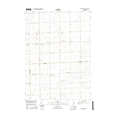
2014 Map of New Greenleaf
USGS Topo · Published 2014About this map
The agricultural landscape of Michigan's Thumb is defined here by the convergence of Huron, Sanilac, and Tuscola counties. The settlement of Ivanhoe sits near the upper reaches of the Pigeon River, while the namesake community of New Greenleaf is positioned further south along S Van Dyke Rd. This area serves as a significant drainage divide for the region, where waters flow toward both the Saginaw Bay and Lake Huron. The northern section is drained by the Sandy Drain and Pigeon River, while the southern half marks the headwaters of the Cass River system, including the North Branch Cass River and the South Fork Cass River. For those tracing local history or family lineage, the presence of the McTaggart Cem and the Saint Columbkille Roman Catholic Cem provides concrete anchors for the early rural parishes that shaped these townships.
Find a feature on this map
52 named features on this map. Tap any name to fly to it.
Don’t see what you’re looking for? This feature index may not catch every label — zoom into the map to look around manually.
Map Details
Editions of this 2014 New Greenleaf Map
This is the sole edition of this map. No revisions or reprints were ever made.
Other maps of this area

1954 · Flint
USGS Topo · 1:250,000

1958 · Flint
USGS Topo · 1:250,000

1963 · New Greenleaf
USGS Topo · 1:24,000

1963 · Ubly
USGS Topo · 1:24,000

1963 · Cass City
USGS Topo · 1:24,000

1963 · Shabbona
USGS Topo · 1:24,000

1963 · Gagetown
USGS Topo · 1:24,000

1963 · Argyle
USGS Topo · 1:24,000

1970 · Bad Axe West
USGS Topo · 1:24,000
1970 · Elkton
USGS Topo · 1:24,000