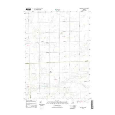
2017 Map of New Greenleaf
USGS Topo · Published 2017About this map
Ivanhoe and New Greenleaf anchor this rural landscape in the Thumb region of Michigan, where the headwaters of several significant drainage systems converge. The terrain is defined by its agricultural layout, intersected by a dense grid of section roads like S Van Dyke Rd and Huron Line Rd. For genealogists and local historians, the map identifies specific landmarks such as McTaggart Cem near Rescue Rd and the Saint Columbkille Roman Catholic Cem situated along the northern reaches of the Pigeon River.
Find a feature on this map
45 named features on this map. Tap any name to fly to it.
Don’t see what you’re looking for? This feature index may not catch every label — zoom into the map to look around manually.
Map Details
Editions of this 2017 New Greenleaf Map
This is the sole edition of this map. No revisions or reprints were ever made.
Other maps of this area

1954 · Flint
USGS Topo · 1:250,000

1958 · Flint
USGS Topo · 1:250,000

1963 · New Greenleaf
USGS Topo · 1:24,000

1963 · Ubly
USGS Topo · 1:24,000

1963 · Cass City
USGS Topo · 1:24,000

1963 · Shabbona
USGS Topo · 1:24,000

1963 · Gagetown
USGS Topo · 1:24,000

1963 · Argyle
USGS Topo · 1:24,000

1970 · Bad Axe West
USGS Topo · 1:24,000
1970 · Elkton
USGS Topo · 1:24,000