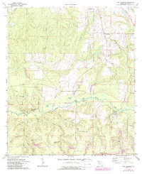
1973 Map of New Harmony
USGS Topo · Published 1987About this map
The Shoal River snakes through this northern Florida landscape, defining a region where dense wetlands meet the high ground of Fox Hill. In the early 1970s, the rural community of New Harmony remained a primary settlement point, while the southern reaches of the map show a complex network of coastal bays including Piney Woods Bay, Dios Bay, and Turner Bay. These "bays" here are not open water but characteristic swampy depressions, typical of the Florida panhandle's interior drainage patterns.
Find a feature on this map
35 named features on this map. Tap any name to fly to it.
Don’t see what you’re looking for? This feature index may not catch every label — zoom into the map to look around manually.
Map Details
Editions of this 1973 New Harmony Map
2 editions found
Other maps of this area

1934 · Niceville
USGS Topo · 1:48,000

1935 · De Funiak Springs
USGS Topo · 1:48,000

1936 · Niceville
USGS Topo · 1:62,500

1938 · De Funiak Springs
USGS Topo · 1:62,500

1949 · Glendale
USGS Topo · 1:62,500

1949 · Laurel Hill
USGS Topo · 1:62,500

1950 · Laurel Hill
USGS Topo · 1:62,500

1951 · Glendale
USGS Topo · 1:62,500

1956 · Niceville
USGS Topo · 1:62,500

1957 · Pensacola
USGS Topo · 1:250,000