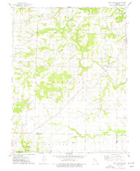
1973 Map of New Hartford
USGS Topo · Published 1977About this map
New Hartford sits at the convergence of several rural drainages including Indian Creek and Brush Creek in the northeastern corner of Pike County. This early 1970s landscape is defined by its deep network of family cemeteries and country churches, reflecting a long-standing agricultural community. Places of worship such as Siloam Ch, Smyrna Ch, and West Prairie Ch are scattered across the townships of Hartford and Prairie, often located near prominent homestead landmarks like Willis Cem or Ashley Cem. To the south, the village of Marling and the Central Grove Community Center anchor the border near the Pike and Montgomery County line. The map captures the intricate hydraulic pattern of the region, where numerous branches like Wolfpen Branch and Henderson Branch feed into the North Fork Cuivre River, illustrating the rugged terrain that dictated early settlement and road placement.
Find a feature on this map
40 named features on this map. Tap any name to fly to it.
Don’t see what you’re looking for? This feature index may not catch every label — zoom into the map to look around manually.
Map Details
Editions of this 1973 New Hartford Map
This is the sole edition of this map. No revisions or reprints were ever made.
Other maps of this area

1890 · Louisiana
USGS Topo · 1:125,000

1937 · Silex
USGS Topo · 1:62,500

1937 · Bowling Green
USGS Topo · 1:62,500

1939 · Silex
USGS Topo · 1:48,000

1940 · Bowling Green
USGS Topo · 1:62,500

1942 · Bellflower
USGS Topo · 1:62,500

1943 · Vandalia
USGS Topo · 1:62,500

1945 · Bellflower
USGS Topo · 1:62,500

1945 · Vandalia
USGS Topo · 1:62,500

1948 · Quincy
USGS Topo · 1:250,000