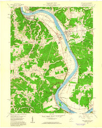
1958 Map of New Haven
USGS Topo · Published 1960About this map
The Ohio River defines the western border of West Virginia in this late 1950s study, shaping a landscape of river-bend settlements and industrial infrastructure. The Baltimore and Ohio railroad tracks follow the river's curve, connecting established communities like New Haven and Hartford City to the Graham Station Powerplant and the nearby Vanadium Plant. These industrial sites contrast with the deeply dissected uplands of Graham and Letart districts, where small family cemeteries and country churches like Bachtel Ch and Union Ch anchor rural neighborhoods.
Find a feature on this map
73 named features on this map. Tap any name to fly to it.
Don’t see what you’re looking for? This feature index may not catch every label — zoom into the map to look around manually.
Map Details
Editions of this 1958 New Haven Map
This is the sole edition of this map. No revisions or reprints were ever made.
Other maps of this area

1907 · Pomeroy
USGS Topo · 1:62,500

1907 · Keno
USGS Topo · 1:62,500

1908 · Ravenswood
USGS Topo · 1:62,500

1908 · Point Pleasant
USGS Topo · 1:62,500

1926 · Ravenswood
USGS Topo · 1:62,500

1926 · Point Pleasant
USGS Topo · 1:62,500

1928 · Ravenswood
USGS Topo · 1:62,500

1929 · Point Pleasant
USGS Topo · 1:62,500

1947 · Columbus
USGS Topo · 1:250,000

1949 · Clarksburg
USGS Topo · 1:250,000