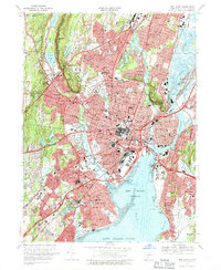
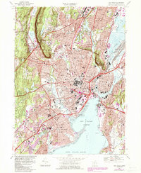
1967 Map of New Haven
USGS Topo · Published 1970About this map
Yale University and its historic core dominate the urban center of this 1960s landscape, surrounded by the established neighborhoods of New Haven, Hamden, and West Haven. The map captures the city at a moment of significant infrastructure, with the Connecticut Turnpike and Wilbur Cross Parkway carving through the terrain near landmarks like the Yale Bowl and Southern Connecticut State College. The coastal reach extends from City Point to Morris Cove, showing the industrial and maritime layout of New Haven Harbor and the Tweed-New Haven Airport before later expansion.
Find a feature on this map
127 named features on this map. Tap any name to fly to it.
Don’t see what you’re looking for? This feature index may not catch every label — zoom into the map to look around manually.
Map Details
Editions of this 1967 New Haven Map
5 editions found
Other maps of this area

1889 · Derby
USGS Topo · 1:62,500

1891 · Bridgeport
USGS Topo · 1:62,500

1891 · Derby
USGS Topo · 1:62,500

1892 · New Haven
USGS Topo · 1:62,500

1893 · Bridgeport
USGS Topo · 1:62,500

1893 · Derby
USGS Topo · 1:62,500

1920 · Bridgeport
USGS Topo · 1:62,500

1921 · New Haven
USGS Topo · 1:62,500

1943 · New Haven
USGS Topo · 1:31,680

1943 · Naugatuck
USGS Topo · 1:31,680