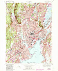
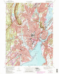
1967 Map of New Haven
USGS Topo · Published 1985About this map
Yale University and its sprawling urban campus anchor this mid-century view of the Elm City, showing the dense development of the city center alongside its historic cemeteries and emerging postwar infrastructure. The map documents the intricate street grids of New Haven and West Haven before the full impact of late-century redevelopment, featuring local landmarks like the Yale Bowl and the massive VA Hospital complex. Transportation corridors are well-defined, from the older Boston Post Rd to the more modern Wilbur Cross Parkway and the busy Amtrak rail lines along the coast. Natural features like West Rock Ridge and the Quinnipiac River frame the industrial and residential growth of neighborhoods such as Fair Haven and Westville. For researchers, the level of detail is exceptional, capturing dozens of parochial schools, named cemeteries like Grove Street Cemetery, and coastal developments around New Haven Harbor.
Find a feature on this map
132 named features on this map. Tap any name to fly to it.
Don’t see what you’re looking for? This feature index may not catch every label — zoom into the map to look around manually.
Map Details
Editions of this 1967 New Haven Map
5 editions found
Other maps of this area

1889 · Derby
USGS Topo · 1:62,500

1891 · Bridgeport
USGS Topo · 1:62,500

1891 · Derby
USGS Topo · 1:62,500

1892 · New Haven
USGS Topo · 1:62,500

1893 · Bridgeport
USGS Topo · 1:62,500

1893 · Derby
USGS Topo · 1:62,500

1920 · Bridgeport
USGS Topo · 1:62,500

1921 · New Haven
USGS Topo · 1:62,500

1943 · New Haven
USGS Topo · 1:31,680

1943 · Naugatuck
USGS Topo · 1:31,680