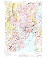
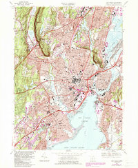
1967 Map of New Haven
USGS Topo · Published 1974About this map
Yale University and its iconic Yale Bowl anchor the urban landscape of this mid-century New Haven coastal survey. The map details a dense corridor of educational and medical institutions, including Albertus Magnus College, Southern Connecticut State College, and the sprawling Veterans Hospital complex. Urban expansion is noted through purple revisions, showing the growth of neighborhoods like Westville, Allingtown, and Fair Haven around the industrial and maritime infrastructure of New Haven Harbor.
Find a feature on this map
106 named features on this map. Tap any name to fly to it.
Don’t see what you’re looking for? This feature index may not catch every label — zoom into the map to look around manually.
Map Details
Editions of this 1967 New Haven Map
5 editions found
Other maps of this area

1889 · Derby
USGS Topo · 1:62,500

1891 · Bridgeport
USGS Topo · 1:62,500

1891 · Derby
USGS Topo · 1:62,500

1892 · New Haven
USGS Topo · 1:62,500

1893 · Bridgeport
USGS Topo · 1:62,500

1893 · Derby
USGS Topo · 1:62,500

1920 · Bridgeport
USGS Topo · 1:62,500

1921 · New Haven
USGS Topo · 1:62,500

1943 · New Haven
USGS Topo · 1:31,680

1943 · Naugatuck
USGS Topo · 1:31,680