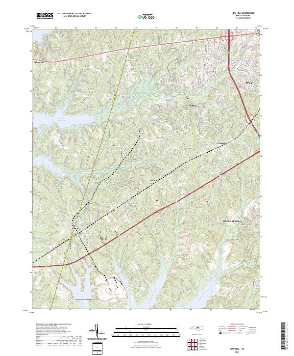
2022 Map of New Hill
USGS Topo · Published 2022About this map
New Hill and the surrounding southwestern corner of Wake County are defined by a complex network of creeks and modern residential growth. The landscape is characterized by the significant presence of B Everett Jordan Lake along the western edge, where Beaver Creek and Weaver Cr drain into the reservoir. Small unincorporated communities like Bonsal and Friendship represent the area's rural roots, while the expanding margins of Apex and Holly Springs signal the region's contemporary development. Transport and infrastructure are prominent, with the Deck Airpark and numerous named family roads like Johnson Farm Rd and Olives Chapel Rd carving through the terrain. The map captures a transition where traditional landholdings, such as Country Creek Farm and Cedar Lane Farm, interface with newer subdivisions and significant water management systems like Little White Oak Creek.
Find a feature on this map
154 named features on this map. Tap any name to fly to it.
Don’t see what you’re looking for? This feature index may not catch every label — zoom into the map to look around manually.
Map Details
Editions of this 2022 New Hill Map
This is the sole edition of this map. No revisions or reprints were ever made.
Other maps of this area

1943 · Durham South
USGS Topo · 1:62,500

1951 · Farrington
USGS Topo · 1:24,000

1951 · Durham South
USGS Topo · 1:62,500

1953 · Raleigh
USGS Topo · 1:250,000

1954 · Raleigh
USGS Topo · 1:250,000

1969 · New Hope Dam
USGS Topo · 1:24,000

1970 · Moncure
USGS Topo · 1:24,000
1973 · Cary
USGS Topo · 1:24,000
1973 · Green Level
USGS Topo · 1:24,000

1974 · Apex
USGS Topo · 1:24,000