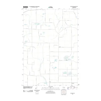
2010 Map of New Hope
USGS Topo · Published 2010About this map
Glacial lakes and meandering waterways define the central Wisconsin landscape in this survey of the New Hope region. The Tomorrow River winds through the western half of the quadrangle, feeding into Nelsonville Pond 69 near the southern border. This area is characterized by numerous kettle lakes, including the cluster of Sunset Lake, Minister Lake, and Skunk Lake, which serves as a backdrop for the Chick-A-Gami Bay Scout Camp.
Find a feature on this map
64 named features on this map. Tap any name to fly to it.
Don’t see what you’re looking for? This feature index may not catch every label — zoom into the map to look around manually.
Map Details
Editions of this 2010 New Hope Map
This is the sole edition of this map. No revisions or reprints were ever made.
Other maps of this area

1955 · Tigerton
USGS Topo · 1:48,000

1955 · Rosholt
USGS Topo · 1:48,000

1955 · Green Bay
USGS Topo · 1:250,000

1957 · Amherst
USGS Topo · 1:48,000

1957 · Waupaca
USGS Topo · 1:48,000

1969 · Rosholt
USGS Topo · 1:24,000

1969 · New Hope
USGS Topo · 1:24,000

1969 · Arnott
USGS Topo · 1:24,000

1969 · Rosholt NW
USGS Topo · 1:24,000
1969 · Scandinavia
USGS Topo · 1:24,000