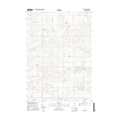
2015 Map of New Hope
USGS Topo · Published 2015About this map
Nelsonville and the surrounding township of New Hope are the primary centers of this Portage County landscape. The area is defined by a dense cluster of glacial kettle lakes, particularly in the eastern sections where Sunset Lake, Mihister Lake, and Skunk Lake sit in close proximity. The Tomorrow River winds through the western half of the map, while the small community of Garfield serves as a local landmark further north. Genealogy researchers will find the Nelsonville Cem near the southern boundary, situated along the road network that connects these rural farmsteads and glacial features. The map illustrates a transition from the river valley in the west to the high density of small water bodies like Reton Lake and Hintz Lake that characterize this central Wisconsin terrain.
Find a feature on this map
75 named features on this map. Tap any name to fly to it.
Don’t see what you’re looking for? This feature index may not catch every label — zoom into the map to look around manually.
Map Details
Editions of this 2015 New Hope Map
This is the sole edition of this map. No revisions or reprints were ever made.
Other maps of this area

1955 · Tigerton
USGS Topo · 1:48,000

1955 · Rosholt
USGS Topo · 1:48,000

1955 · Green Bay
USGS Topo · 1:250,000

1957 · Amherst
USGS Topo · 1:48,000

1957 · Waupaca
USGS Topo · 1:48,000

1969 · Rosholt
USGS Topo · 1:24,000

1969 · New Hope
USGS Topo · 1:24,000

1969 · Arnott
USGS Topo · 1:24,000

1969 · Rosholt NW
USGS Topo · 1:24,000
1969 · Scandinavia
USGS Topo · 1:24,000