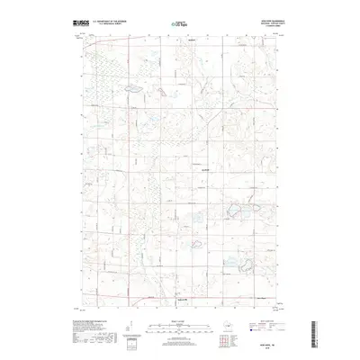
2018 Map of New Hope
USGS Topo · Published 2018About this map
Nelsonville and Rosholt anchor this portion of Portage County, where the Tomorrow River winds through a landscape defined by glacial activity and a high density of kettle lakes. The southern reach of the map features the village of Nelsonville and the nearby Nelsonville Cem, providing a focal point for genealogical research in the township. Moving north, the small settlement of Garfield and the community of New Hope sit amidst a complex network of county roads like Co Rd Z and Co Rd OO. The area is notably water-rich, featuring numerous named bodies such as Collins Lake, Rinehart Lake, and the adjacent Sunset Lake and Minister Lake. This drainage pattern, including Flume Cr and Nice Cr, reveals the intricate hydrology that has historically influenced land use and settlement patterns in this central Wisconsin region.
Find a feature on this map
36 named features on this map. Tap any name to fly to it.
Don’t see what you’re looking for? This feature index may not catch every label — zoom into the map to look around manually.
Map Details
Editions of this 2018 New Hope Map
This is the sole edition of this map. No revisions or reprints were ever made.
Other maps of this area

1955 · Tigerton
USGS Topo · 1:48,000

1955 · Rosholt
USGS Topo · 1:48,000

1955 · Green Bay
USGS Topo · 1:250,000

1957 · Amherst
USGS Topo · 1:48,000

1957 · Waupaca
USGS Topo · 1:48,000

1969 · Rosholt
USGS Topo · 1:24,000

1969 · New Hope
USGS Topo · 1:24,000

1969 · Arnott
USGS Topo · 1:24,000

1969 · Rosholt NW
USGS Topo · 1:24,000
1969 · Scandinavia
USGS Topo · 1:24,000