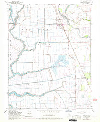
1952 Map of New Hope
USGS Topo · Published 1969About this map
The Mokelumne River and its complex network of sloughs define the agricultural landscape of this San Joaquin Valley region during the mid-20th century. At the heart of the map is the community of Thornton, situated near the Western Pacific railroad and the New Hope Sch. The terrain is divided into large agricultural tracts, including the New Hope Tract, Brack Tract, and Terminous Tract, which are protected by a extensive system of levees. Significant water management infrastructure is evident throughout the area, featuring numerous labeled siphons, pump houses, and the Delta Cross Channel. The presence of the Farm Labor Center and the New Hope Landing reflect the labor-intensive nature of the local river-and-rail based economy during this era of intensive irrigation and land reclamation.
Find a feature on this map
31 named features on this map. Tap any name to fly to it.
Don’t see what you’re looking for? This feature index may not catch every label — zoom into the map to look around manually.
Map Details
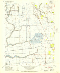
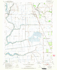
Editions of this 1952 New Hope Map
3 editions found
Other maps of this area

1894 · Lodi
USGS Topo · 1:125,000

1908 · Courtland
USGS Topo · 1:62,500

1910 · New Hope
USGS Topo · 1:31,680

1910 · Castle
USGS Topo · 1:31,680

1910 · Bouldin
USGS Topo · 1:31,680

1910 · Woodbridge
USGS Topo · 1:31,680

1910 · Bruceville
USGS Topo · 1:31,680

1910 · Headreach
USGS Topo · 1:31,680

1910 · Galt
USGS Topo · 1:31,680

1910 · Isleton
USGS Topo · 1:31,680