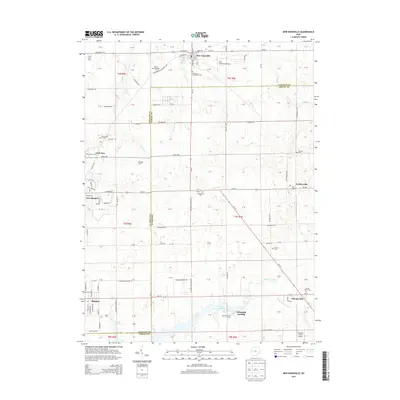
2013 Map of New Knoxville
USGS Topo · Published 2013About this map
New Knoxville sits at the junction of State Route 219 and Oh-29, anchoring a landscape defined by its agricultural heritage and civil aviation. Just east of the village, the Neil Armstrong Airport serves as a modern landmark in a region deeply rooted in history, evidenced by numerous burial grounds such as Protestant Evangelical Cem and Schwaberow Cem. To the south, the waters of Lake Loramie and Loramie Creek shape the drainage patterns, which include engineered features like the White Feather Ditch. The map illustrates the border between Auglaize and Shelby counties, where small settlements like Kettlersville, Lock Two, and the northern edge of Minster are connected by a grid of farm-to-market roads. This network links established family holdings such as Roediger Farms and Berning Family Farms to the larger market centers.
Find a feature on this map
84 named features on this map. Tap any name to fly to it.
Don’t see what you’re looking for? This feature index may not catch every label — zoom into the map to look around manually.
Map Details
Editions of this 2013 New Knoxville Map
This is the sole edition of this map. No revisions or reprints were ever made.
Other maps of this area

1906 · Lima
USGS Topo · 1:62,500

1909 · Loramie
USGS Topo · 1:62,500

1911 · Loramie
USGS Topo · 1:62,500

1911 · Spencerville
USGS Topo · 1:62,500

1913 · Sidney
USGS Topo · 1:62,500

1944 · Sidney
USGS Topo · 1:62,500

1944 · Loramie
USGS Topo · 1:62,500

1944 · Spencerville
USGS Topo · 1:62,500

1953 · Muncie
USGS Topo · 1:250,000

1956 · Muncie
USGS Topo · 1:250,000