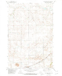
1980 Map of New Leipzig North
USGS Topo · Published 1980About this map
New Leipzig and the surrounding prairie of Grant County are defined by a high-plains landscape shaped by both agriculture and mineral extraction. The southern edge of the map follows the corridor of the Chicago Milwaukee St Paul and Northern Pacific railroad, which historically anchored the local economy. North of the tracks, the terrain rises into the Heim Hills and Frey Hills, while Antelope Creek meanders through the northern sections of the township.
Find a feature on this map
15 named features on this map. Tap any name to fly to it.
Don’t see what you’re looking for? This feature index may not catch every label — zoom into the map to look around manually.
Map Details
Editions of this 1980 New Leipzig North Map
This is the sole edition of this map. No revisions or reprints were ever made.
Other maps of this area

1938 · Heart Butte
USGS Topo · 1:48,000

1944 · Heart Butte
USGS Topo · 1:62,500

1953 · Dickinson
USGS Topo · 1:250,000

1954 · Bismarck
USGS Topo · 1:250,000

1957 · Dickinson
USGS Topo · 1:250,000

1958 · Bismarck
USGS Topo · 1:250,000

1960 · Clark Butte
USGS Topo · 1:24,000

1969 · North Star Butte
USGS Topo · 1:24,000

1969 · Bentley
USGS Topo · 1:24,000

1972 · New Leipzig South
USGS Topo · 1:24,000