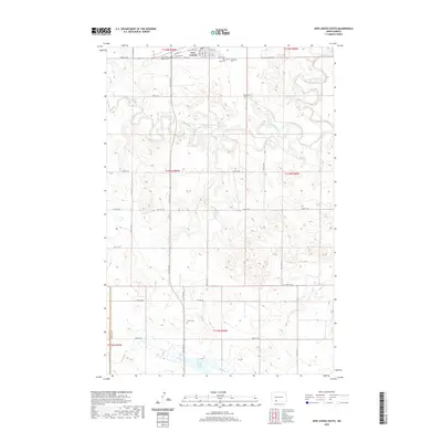
2020 Map of New Leipzig South
USGS Topo · Published 2020About this map
New Leipzig anchors the northern edge of this North Dakota landscape, where the town's early history is preserved in a significant cluster of religious burial grounds including New Leipzig Baptist Cem, Congregation Cem, Saint Johns Cem, and Immanuel Cem. The topography is defined by the winding course of the Cannonball River which snakes through the northern sections, and Sheep Cr to the south. Further south, the map reveals more isolated landmarks such as Finnish Cem and Fleak Cem, alongside the waters of Pretty Rock Lake. This 2020 update reflects the enduring section-line road grid, from 72nd St SW to 80th St SW, which has organized the agricultural life of Grant County and neighboring Hettinger County for generations.
Find a feature on this map
36 named features on this map. Tap any name to fly to it.
Don’t see what you’re looking for? This feature index may not catch every label — zoom into the map to look around manually.
Map Details
Editions of this 2020 New Leipzig South Map
This is the sole edition of this map. No revisions or reprints were ever made.
Other maps of this area

1953 · Dickinson
USGS Topo · 1:250,000

1954 · Bismarck
USGS Topo · 1:250,000

1957 · Dickinson
USGS Topo · 1:250,000

1958 · Bismarck
USGS Topo · 1:250,000

1969 · North Star Butte
USGS Topo · 1:24,000

1969 · Bentley
USGS Topo · 1:24,000

1972 · Coffin Buttes
USGS Topo · 1:24,000

1972 · New Leipzig South
USGS Topo · 1:24,000

1972 · Pretty Rock Butte
USGS Topo · 1:24,000

1972 · Sheep Creek Dam
USGS Topo · 1:24,000