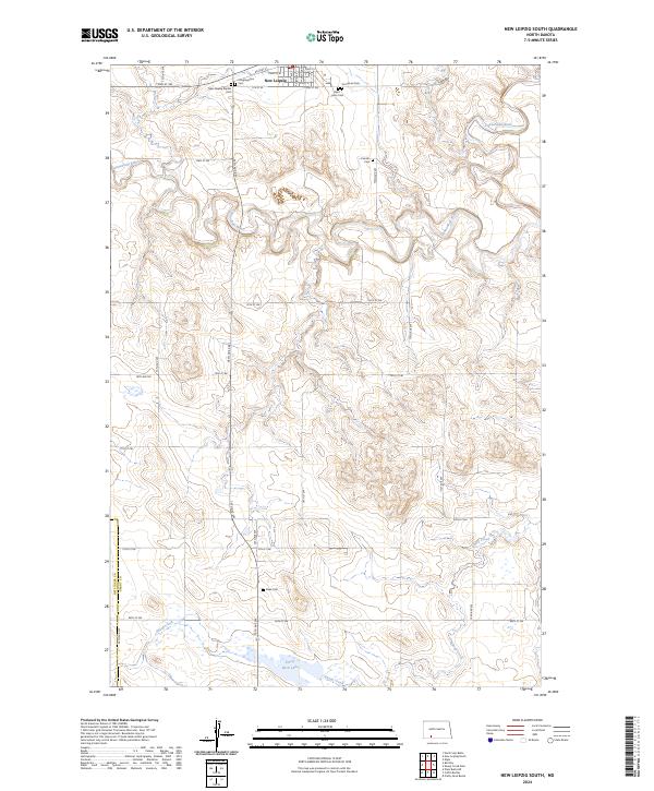
2024 Map of New Leipzig South
USGS Topo · Published 2024About this map
New Leipzig sits at the northern edge of this landscape, where the BNSF Railway parallels the high ground above the Cannonball River. This contemporary survey of the rural boundary between Grant and Hettinger counties reveals a territory defined by historic community clusters, particularly evident through its numerous small burial grounds. The distribution of sites like the Finnish Cem, New Leipzig Baptist Cem, and Fleak Cem suggests the scattered nature of early homesteading patterns that persist today. To the south, the terrain descends toward Pretty Rock Lake and the branching waters of Sheep Creek, illustrating a prairie environment where water sources and rail access dictated the placement of every farmstead and faith-based community center.
Find a feature on this map
34 named features on this map. Tap any name to fly to it.
Don’t see what you’re looking for? This feature index may not catch every label — zoom into the map to look around manually.
Map Details
Editions of this 2024 New Leipzig South Map
This is the sole edition of this map. No revisions or reprints were ever made.
Other maps of this area

1953 · Dickinson
USGS Topo · 1:250,000

1954 · Bismarck
USGS Topo · 1:250,000

1957 · Dickinson
USGS Topo · 1:250,000

1958 · Bismarck
USGS Topo · 1:250,000

1969 · North Star Butte
USGS Topo · 1:24,000

1969 · Bentley
USGS Topo · 1:24,000

1972 · Coffin Buttes
USGS Topo · 1:24,000

1972 · New Leipzig South
USGS Topo · 1:24,000

1972 · Pretty Rock Butte
USGS Topo · 1:24,000

1972 · Sheep Creek Dam
USGS Topo · 1:24,000