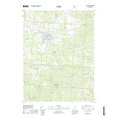
2019 Map of New Lexington
USGS Topo · Published 2019About this map
New Lexington serves as the focal point of this Perry County landscape, centered on the Perry County Courthouse and surrounding street grid. The settlement pattern reflects a mix of civic infrastructure and industrial footprints, notably the Sunnyhill Slurry Impoundment to the east. To the south, the terrain transitions into the protected woodlands of the Wayne National Forest, where steep drainages like Dixie Hollow and Jobs Hollow cut through the ridges. Smaller communities such as Rehoboth, Bristol, and Moxahala dot the outlying valleys, often marked by local landmarks like the Old Baptist Church Cem or the First Methodist Church. The map captures a contemporary look at this Appalachian plateau region, where historical cemeteries like Saint Aloysius Cem and Vansickle Cem stand alongside modern developments like the Perry County Airport.
Find a feature on this map
100 named features on this map. Tap any name to fly to it.
Don’t see what you’re looking for? This feature index may not catch every label — zoom into the map to look around manually.
Map Details
Editions of this 2019 New Lexington Map
This is the sole edition of this map. No revisions or reprints were ever made.
Other maps of this area

1907 · Logan
USGS Topo · 1:62,500

1909 · Thornville
USGS Topo · 1:62,500

1909 · Logan
USGS Topo · 1:62,500

1910 · Zanesville
USGS Topo · 1:62,500

1911 · New Lexington
USGS Topo · 1:62,500

1947 · Columbus
USGS Topo · 1:250,000

1961 · Columbus
USGS Topo · 1:250,000

1961 · Corning
USGS Topo · 1:24,000

1961 · New Lexington
USGS Topo · 1:24,000

1961 · Deavertown
USGS Topo · 1:24,000