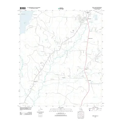
2012 Map of New Llano
USGS Topo · Published 2012About this map
Anacoco Lake dominates the northwestern corner of this Vernon Parish landscape, its shoreline dotted with recreational and residential markers like Methodist Landing, Red McManus Camp, and Lunkers Cove Rd. The terrain is defined by a dense network of winding waterways, including Bayou Castor and Bayou Zourie, which weave through the central and southern sections. These drainage patterns influenced the placement of early settlements and family landmarks, with New Llano serving as a primary hub in the northeast near Chateau Place.
Find a feature on this map
128 named features on this map. Tap any name to fly to it.
Don’t see what you’re looking for? This feature index may not catch every label — zoom into the map to look around manually.
Map Details
Editions of this 2012 New Llano Map
This is the sole edition of this map. No revisions or reprints were ever made.
Other maps of this area

1941 · Leesville
USGS Topo · 1:62,500

1941 · Slagle
USGS Topo · 1:62,500

1943 · Leesville
USGS Topo · 1:62,500

1944 · Slagle
USGS Topo · 1:62,500

1946 · Leesville
USGS Topo · 1:62,500

1947 · Rosepine
USGS Topo · 1:31,680

1947 · Knight
USGS Topo · 1:31,680

1947 · Chasmore
USGS Topo · 1:31,680

1948 · Leesville
USGS Topo · 1:62,500

1952 · Lake Charles
USGS Topo · 1:250,000