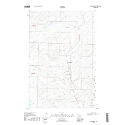
2020 Map of New London
USGS Topo · Published 2020About this map
The Hoquiam river system defines the landscape of this coastal Washington region, where the West Fork, Middle Fork, and East Fork converge north of the city. The settlement of New London sits at a geographic bend in the river, served by local routes like Milbourn Ln and Old State 9 Rd. To the north, the Hoquiam Water Works and the waters of Failor Lake indicate the infrastructure necessary to support the nearby urban center. The topography transitions from the tidal influence of Grays Harbor and Polson Slough in the south toward the timber-rich hills drained by Bernard Cr and Chenois Cr in the northwest. This modern survey provides a detailed look at how historical rural roads such as Chenois Valley Rd and Dekay Rd continue to navigate the complex drainage of the Olympic Peninsula foothills.
Find a feature on this map
36 named features on this map. Tap any name to fly to it.
Don’t see what you’re looking for? This feature index may not catch every label — zoom into the map to look around manually.
Map Details
Editions of this 2020 New London Map
This is the sole edition of this map. No revisions or reprints were ever made.
Other maps of this area

1938 · Moclips
USGS Topo · 1:62,500

1941 · Moclips
USGS Topo · 1:62,500

1941 · Grayland
USGS Topo · 1:62,500

1943 · Humptulips
USGS Topo · 1:62,500

1943 · Copalis Beach
USGS Topo · 1:250,000

1951 · Copalis Beach
USGS Topo · 1:250,000

1953 · Hoquiam
USGS Topo · 1:250,000

1955 · Humptulips
USGS Topo · 1:62,500

1955 · Carlisle
USGS Topo · 1:24,000

1956 · Copalis Crossing
USGS Topo · 1:24,000