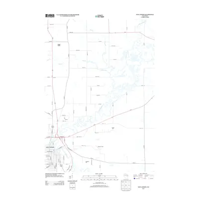
2013 Map of New London
USGS Topo · Published 2013About this map
The Wolf River and Embarrass River dominate this 2013 topographic landscape, converging just south of New London. The intricate meanders of the Embarrass River create a complex wetland pattern north of the city, illustrating the hydrologic character of this part of Wisconsin. Settlement is concentrated in the urban grid of New London, while the outlying areas like Sugar Bush maintain a rural, agricultural layout defined by straight section roads such as Co Hwy-D and Breiting Rd.
Find a feature on this map
76 named features on this map. Tap any name to fly to it.
Don’t see what you’re looking for? This feature index may not catch every label — zoom into the map to look around manually.
Map Details
Editions of this 2013 New London Map
This is the sole edition of this map. No revisions or reprints were ever made.
Other maps of this area

1955 · Embarrass
USGS Topo · 1:48,000

1955 · Clintonville
USGS Topo · 1:48,000

1955 · Green Bay
USGS Topo · 1:250,000

1956 · New London
USGS Topo · 1:48,000

1956 · Weyauwega
USGS Topo · 1:48,000

1969 · New London
USGS Topo · 1:24,000

1969 · Readfield
USGS Topo · 1:24,000
1969 · Hortonville
USGS Topo · 1:24,000

1969 · Northport
USGS Topo · 1:24,000

1969 · Leeman
USGS Topo · 1:24,000