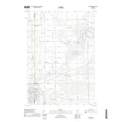
2018 Map of New London
USGS Topo · Published 2018About this map
The New London city center occupies the southwest corner of this landscape, situated at the confluence where the Embarrass River meets the Wolf River. The surrounding terrain transitions from the urban grid into a complex network of wetlands and low-lying drainages, punctuated by distinct elevations such as Mosquito Hill and Turney Hill. These high points often served as logical sites for early community landmarks, evidenced by the presence of the Turney Hill Cem and Mosquito Hill Cem.
Find a feature on this map
64 named features on this map. Tap any name to fly to it.
Don’t see what you’re looking for? This feature index may not catch every label — zoom into the map to look around manually.
Map Details
Editions of this 2018 New London Map
This is the sole edition of this map. No revisions or reprints were ever made.
Other maps of this area

1955 · Embarrass
USGS Topo · 1:48,000

1955 · Clintonville
USGS Topo · 1:48,000

1955 · Green Bay
USGS Topo · 1:250,000

1956 · New London
USGS Topo · 1:48,000

1956 · Weyauwega
USGS Topo · 1:48,000

1969 · New London
USGS Topo · 1:24,000

1969 · Readfield
USGS Topo · 1:24,000
1969 · Hortonville
USGS Topo · 1:24,000

1969 · Northport
USGS Topo · 1:24,000

1969 · Leeman
USGS Topo · 1:24,000