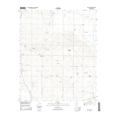
2014 Map of New London
USGS Topo · Published 2014About this map
New London and the surrounding pine-clad landscape of Union County are defined by a complex web of petroleum production and historic timbering. This area, marked by numerous production zones including the North New London Oil and Gas Field and the Sandy Bend Oil Field, shows a landscape where industrial infrastructure and rural heritage coexist. Scattered family and community burial grounds, such as Ebenezer Cem and Ward Chapel Cem, are tucked away near the winding tributaries of Lapoile Cr and Norris Cr. The presence of McGlendon Mill and the settlement of Sawmill underscore the historical importance of the timber industry in this corner of Arkansas. Further north, landmarks like the New London Lookout Tower and named features such as Pine Island and Benjamin Lake break up the undulating terrain, while a dense network of local roads like Pigeon Hill Rd and Camp Rd provides access to remote oil wells and family plots.
Find a feature on this map
63 named features on this map. Tap any name to fly to it.
Don’t see what you’re looking for? This feature index may not catch every label — zoom into the map to look around manually.
Map Details
Editions of this 2014 New London Map
This is the sole edition of this map. No revisions or reprints were ever made.
Other maps of this area

1933 · Strong
USGS Topo · 1:62,500

1934 · Ingalls
USGS Topo · 1:48,000

1934 · Felsenthal
USGS Topo · 1:62,500

1934 · Moro Bay
USGS Topo · 1:62,500

1937 · Strong
USGS Topo · 1:62,500

1937 · Felsenthal
USGS Topo · 1:62,500

1937 · Ingalls
USGS Topo · 1:62,500

1938 · Felsenthal
USGS Topo · 1:62,500

1938 · Moro Bay
USGS Topo · 1:62,500

1939 · Felsenthal
USGS Topo · 1:62,500