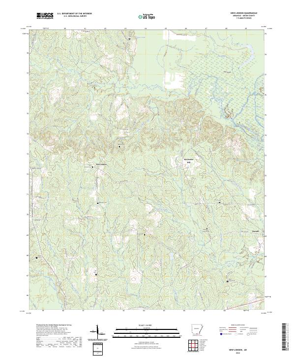
2024 Map of New London
USGS Topo · Published 2024About this map
The settlement of New London sits at the heart of this landscape, where the rolling hills of Union County meet the intricate wetlands of the Felsenthal National Wildlife Refuge. The terrain is defined by a dense network of waterways, including Lapoile Creek, Williams Creek, and the swampy reaches of Cross Bayou and Gum Slough near Pine Island. This environment shaped a community reliant on timber and small-scale industry, evidenced by the presence of McGlendon Mill and a Sawmill on the eastern edge of the quadrangle.
Find a feature on this map
62 named features on this map. Tap any name to fly to it.
Don’t see what you’re looking for? This feature index may not catch every label — zoom into the map to look around manually.
Map Details
Editions of this 2024 New London Map
This is the sole edition of this map. No revisions or reprints were ever made.
Other maps of this area

1933 · Strong
USGS Topo · 1:62,500

1934 · Ingalls
USGS Topo · 1:48,000

1934 · Felsenthal
USGS Topo · 1:62,500

1934 · Moro Bay
USGS Topo · 1:62,500

1937 · Strong
USGS Topo · 1:62,500

1937 · Felsenthal
USGS Topo · 1:62,500

1937 · Ingalls
USGS Topo · 1:62,500

1938 · Felsenthal
USGS Topo · 1:62,500

1938 · Moro Bay
USGS Topo · 1:62,500

1939 · Felsenthal
USGS Topo · 1:62,500