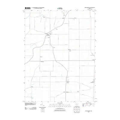
2010 Map of New Madison
USGS Topo · Published 2010About this map
The New Madison settlement anchors this survey of southwestern Darke County and northern Preble County, showing the intersection of agricultural grid-roads and local drainage patterns. North of town, the Marland Peat Pits represent a localized mineral extraction site near the headwaters of the Lake Branch Ditch. The landscape is primarily defined by its cemetery history, with several family-named or church-affiliated grounds including the First Universalist Cemetery and Greenmound Cemetery. Several small villages and hamlets punctuate the region, including Eldorado and Hamburg to the south, and Castine to the east. The hydrography of the area is shaped by the East Fork Whitewater River and Price Creek, which gather the runoff from numerous named branches like Brinley Fork and Little Creek. This study provides a detailed record of the road network and property boundaries such as Preble Cty Butler Twp Rd during the first decade of the 21st century.
Find a feature on this map
69 named features on this map. Tap any name to fly to it.
Don’t see what you’re looking for? This feature index may not catch every label — zoom into the map to look around manually.
Map Details
Editions of this 2010 New Madison Map
This is the sole edition of this map. No revisions or reprints were ever made.
Other maps of this area

1915 · New Paris
USGS Topo · 1:48,000

1916 · Winchester
USGS Topo · 1:48,000

1918 · Winchester
USGS Topo · 1:62,500

1918 · New Paris
USGS Topo · 1:62,500

1943 · Winchester
USGS Topo · 1:62,500

1953 · Cincinnati
USGS Topo · 1:250,000

1953 · Muncie
USGS Topo · 1:250,000

1956 · Muncie
USGS Topo · 1:250,000

1957 · Cincinnati
USGS Topo · 1:250,000

1960 · New Madison
USGS Topo · 1:24,000