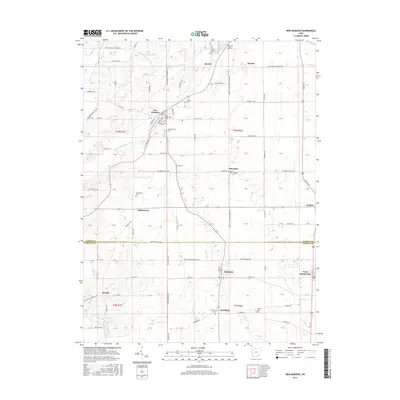
2016 Map of New Madison
USGS Topo · Published 2016About this map
New Madison and its neighboring villages sit within a landscape defined by the agricultural drainage of the E Fork Whitewater River and several small tributaries like Price Cr and Mud Cr. This 2016 survey shows a pattern of rural settlement typical of Darke and Preble counties, where small crossroads communities like Otterbein, Castine, and Hamburg are anchored by family cemeteries and country churches. The terrain is marked by distinctive elevations such as the Hills of Judea in the north and several small water bodies including Halls Lake and the Lake Br Ditch. Genealogists will find a wealth of local landmarks, from the First Universalist Ch in the heart of town to numerous burial sites such as Greenmound Cem, Harter Cem, and Wilt Cem, providing a clear record of the area's established family footprints.
Find a feature on this map
110 named features on this map. Tap any name to fly to it.
Don’t see what you’re looking for? This feature index may not catch every label — zoom into the map to look around manually.
Map Details
Editions of this 2016 New Madison Map
This is the sole edition of this map. No revisions or reprints were ever made.
Other maps of this area

1915 · New Paris
USGS Topo · 1:48,000

1916 · Winchester
USGS Topo · 1:48,000

1918 · Winchester
USGS Topo · 1:62,500

1918 · New Paris
USGS Topo · 1:62,500

1943 · Winchester
USGS Topo · 1:62,500

1953 · Cincinnati
USGS Topo · 1:250,000

1953 · Muncie
USGS Topo · 1:250,000

1956 · Muncie
USGS Topo · 1:250,000

1957 · Cincinnati
USGS Topo · 1:250,000

1960 · New Madison
USGS Topo · 1:24,000