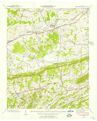
1939 Map of New Market
USGS Topo · Published 1956About this map
New Market and the surrounding Rocky Valley are defined by a mix of agricultural landscape and industrial activity, notably the Zinc Mine near the center of the sheet. The Southern railroad connects the primary settlements, including Friends Station and Jefferson City, following the path of the Andrews Highway. This 1939 field examination reveals a highly developed network of rural infrastructure, with numerous family and community landmarks such as Dinwoody Mill, Tate Mill, and the Piedmont Cem.
Find a feature on this map
53 named features on this map. Tap any name to fly to it.
Don’t see what you’re looking for? This feature index may not catch every label — zoom into the map to look around manually.
Map Details
Editions of this 1939 New Market Map
This is the sole edition of this map. No revisions or reprints were ever made.
Other maps of this area

1883 · Morristown
USGS Topo · 1:125,000

1886 · Knoxville
USGS Topo · 1:125,000

1892 · Knoxville
USGS Topo · 1:125,000

1893 · Mt Guyot
USGS Topo · 1:125,000

1893 · Morristown
USGS Topo · 1:125,000

1894 · Knoxville
USGS Topo · 1:125,000

1895 · Morristown
USGS Topo · 1:125,000

1895 · Knoxville
USGS Topo · 1:125,000

1897 · Maynardville
USGS Topo · 1:125,000

1900 · Maynardville
USGS Topo · 1:125,000