
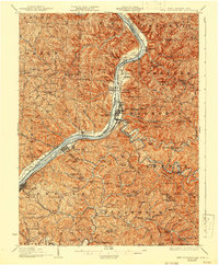
1926 Map of New Martinsville
USGS Topo · Published 1926About this map
The Ohio River carves a deep valley through this 1920s landscape, serving as the industrial and transport artery for towns like New Martinsville, Sistersville, and Paden City. Along the West Virginia bank, the Baltimore and Ohio railroad follows the water's edge, connecting riverfront hubs and supporting local infrastructure like the County Infirmary and Hannibal Station. The rugged interior is defined by a dense network of country schools and churches, including Rothlisberger School, Doolin School, and Gorman Baptist Church, which served the scattered farming communities on ridges like Friendship Ridge. Small islands and towheads, such as Paden Island and Witten Towhead, dot the river channel, while deep-cut tributaries like Fishing Creek and Middle Island Creek wind through the hills. This era shows the transition from rural mills like Winders Mill to the established riverfront rail towns that define the region's economy.
Find a feature on this map
113 named features on this map. Tap any name to fly to it.
Don’t see what you’re looking for? This feature index may not catch every label — zoom into the map to look around manually.
Map Details
Editions of this 1926 New Martinsville Map
2 editions found
Other maps of this area

1903 · Littleton
USGS Topo · 1:62,500

1904 · Cameron
USGS Topo · 1:62,500

1905 · Centerpoint
USGS Topo · 1:62,500

1905 · West Union
USGS Topo · 1:62,500

1905 · Littleton
USGS Topo · 1:62,500

1905 · Clarington
USGS Topo · 1:62,500

1905 · New Matamoras
USGS Topo · 1:62,500

1905 · Woodsfield
USGS Topo · 1:62,500

1906 · Saint Marys
USGS Topo · 1:62,500

1906 · New Martinsville
USGS Topo · 1:62,500