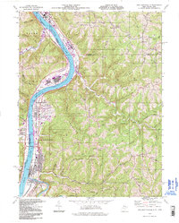
1994 Map of New Martinsville
USGS Topo · Published 1998About this map
New Martinsville and its river-dependent neighbors anchor this stretch of the Ohio River in the mid-1990s. The landscape is defined by the sharp transition between the industrial and residential riverfront and the intricate ridge systems of the Allegheny Plateau. Large-scale infrastructure like the Hannibal Locks and Dam and the industrial facilities at Natrium contrast with the rural character found atop American Ridge and Schupbach Ridge. The map documents a dense layering of community landmarks in and around the county seat, including the Steelton Sch, the County Infirmary, and various hilltop burial grounds such as Mt Zion Cem. Transportation is dominated by the Conrail line hugging the eastern bank, while the interior is dotted with scattered gas and oil wells, reflecting the enduring presence of the regional energy industry amidst a network of small runs and forks like Proctor Creek and Fishing Creek.
Find a feature on this map
65 named features on this map. Tap any name to fly to it.
Don’t see what you’re looking for? This feature index may not catch every label — zoom into the map to look around manually.
Map Details
Editions of this 1994 New Martinsville Map
This is the sole edition of this map. No revisions or reprints were ever made.
Other maps of this area

1903 · Littleton
USGS Topo · 1:62,500

1904 · Cameron
USGS Topo · 1:62,500

1905 · Littleton
USGS Topo · 1:62,500

1905 · Clarington
USGS Topo · 1:62,500

1906 · New Martinsville
USGS Topo · 1:62,500

1924 · New Martinsville
USGS Topo · 1:62,500

1924 · Littleton
USGS Topo · 1:62,500

1926 · Littleton
USGS Topo · 1:62,500

1926 · New Martinsville
USGS Topo · 1:62,500

1935 · Cameron
USGS Topo · 1:62,500