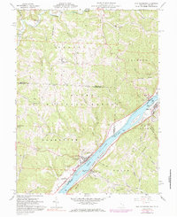
1960 Map of New Matamoras
USGS Topo · Published 1984About this map
New Matamoras and the opposite bank at Friendly anchor this riverfront survey, which documents the mid-century landscape along the Ohio River border between Ohio and West Virginia. The river is a corridor of industry and transport, featuring the Baltimore and Ohio railroad corridor on the eastern bank and a series of large river features including Crab Island, Wells Island, and Mill Creek Island. A ferry crossing at Fly connects the two states, while the interior of Monroe County is characterized by the wooded ridges of the Wayne National Forest.
Find a feature on this map
67 named features on this map. Tap any name to fly to it.
Don’t see what you’re looking for? This feature index may not catch every label — zoom into the map to look around manually.
Map Details
Editions of this 1960 New Matamoras Map
4 editions found
Other maps of this area

1905 · West Union
USGS Topo · 1:62,500

1905 · New Matamoras
USGS Topo · 1:62,500

1906 · Saint Marys
USGS Topo · 1:62,500

1906 · New Martinsville
USGS Topo · 1:62,500

1924 · St Marys
USGS Topo · 1:62,500

1924 · New Martinsville
USGS Topo · 1:62,500

1924 · New Matamoras
USGS Topo · 1:62,500

1924 · West Union
USGS Topo · 1:62,500

1926 · New Martinsville
USGS Topo · 1:62,500

1926 · New Matamoras
USGS Topo · 1:62,500