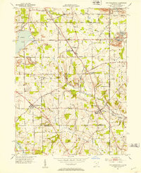
1951 Map of New Middletown
USGS Topo · Published 1953About this map
New Middletown and the surrounding townships of Springfield and Poland occupy the rolling landscape of eastern Ohio during the early 1950s. This survey records a period of significant infrastructure development, most notably the path of the Ohio Turnpike (Under Construction) cutting southeast toward the Pennsylvania border. The map is a vital resource for genealogists, as it documents several historic congregational sites such as Old Springfield Ch and St Lukes Ch, along with numerous local burial grounds including Bethel Cem and Zion Cem. Notable water bodies like Evans Lake and Pine Lake dominate the western portion of the quadrangle, while smaller communities like Ginger Hill and Smith Corners mark the intersections of established rural routes like Calla Road and Western Reserve Rd.
Find a feature on this map
41 named features on this map. Tap any name to fly to it.
Don’t see what you’re looking for? This feature index may not catch every label — zoom into the map to look around manually.
Map Details
Editions of this 1951 New Middletown Map
This is the sole edition of this map. No revisions or reprints were ever made.
Other maps of this area

1902 · New Castle
USGS Topo · 1:62,500

1904 · Newcastle
USGS Topo · 1:62,500

1905 · Neshannock
USGS Topo · 1:62,500

1906 · Youngstown
USGS Topo · 1:62,500

1907 · Neshannock
USGS Topo · 1:62,500

1907 · Columbiana
USGS Topo · 1:62,500

1908 · Youngstown
USGS Topo · 1:62,500

1909 · Columbiana
USGS Topo · 1:62,500

1950 · Cleveland
USGS Topo · 1:250,000

1951 · Canton
USGS Topo · 1:250,000