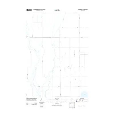
2013 Map of New Miner
USGS Topo · Published 2013About this map
Yellow River and Cranberry Creek define the low-lying drainage patterns of Juneau County in this 2013 survey. The settlement of New Miner serves as a central point of reference, situated north of the expansive Petenwell Lake shore. The map illustrates a strictly organized rural grid system, with roads such as Co Line Rd and Co Hwy-G carving through the landscape. This particular era shows the intersection of traditional land use and modern infrastructure, visible in the way Lipar Rd and Lumby Rd provide access to the wetlands and wooded corridors bordering the river. The detailed topography highlights the subtle elevation shifts in a region defined by its proximity to the Wisconsin River's major flowages.
Find a feature on this map
29 named features on this map. Tap any name to fly to it.
Don’t see what you’re looking for? This feature index may not catch every label — zoom into the map to look around manually.
Map Details
Editions of this 2013 New Miner Map
This is the sole edition of this map. No revisions or reprints were ever made.
Other maps of this area

1953 · Eau Claire
USGS Topo · 1:250,000

1955 · Green Bay
USGS Topo · 1:250,000

1957 · Wisconsin Rapids
USGS Topo · 1:48,000

1957 · Pittsville
USGS Topo · 1:48,000

1958 · Eau Claire
USGS Topo · 1:250,000

1958 · Arkdale
USGS Topo · 1:48,000

1958 · Necedah
USGS Topo · 1:48,000

1964 · Eau Claire
USGS Topo · 1:250,000

1967 · Wisconsin Rapids
USGS Topo · 1:62,500

1967 · Pittsville
USGS Topo · 1:62,500