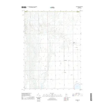
2018 Map of New Miner
USGS Topo · Published 2018About this map
New Miner anchors this rural landscape at the boundary of Wood and Juneau Counties, where a grid of range roads meets the sprawling wetland systems of the Central Wisconsin Sand and Uplands. The terrain is defined by a dense network of watercourses, including the southward-flowing Cranberry Creek and the Yellow River, which ultimately feeds into the expansive Petenwell Lake visible at the southern edge of the quadrangle. For those researching local history, the map provides precise locations for several community landmarks that speak to the area's pioneer heritage, such as Saint Pauls Evangelical Lutheran Cem and the Novotny Cem. This 2018 survey also identifies the Searles Prairie Cem and Zion Cem, offering a detailed look at the scattered rural burial sites and homestead names that have persisted through generations of land use in this marsh-and-meadow region.
Find a feature on this map
39 named features on this map. Tap any name to fly to it.
Don’t see what you’re looking for? This feature index may not catch every label — zoom into the map to look around manually.
Map Details
Editions of this 2018 New Miner Map
This is the sole edition of this map. No revisions or reprints were ever made.
Other maps of this area

1953 · Eau Claire
USGS Topo · 1:250,000

1955 · Green Bay
USGS Topo · 1:250,000

1957 · Wisconsin Rapids
USGS Topo · 1:48,000

1957 · Pittsville
USGS Topo · 1:48,000

1958 · Eau Claire
USGS Topo · 1:250,000

1958 · Arkdale
USGS Topo · 1:48,000

1958 · Necedah
USGS Topo · 1:48,000

1964 · Eau Claire
USGS Topo · 1:250,000

1967 · Wisconsin Rapids
USGS Topo · 1:62,500

1967 · Pittsville
USGS Topo · 1:62,500