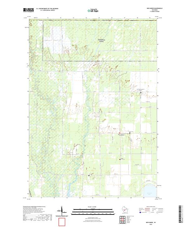
2022 Map of New Miner
USGS Topo · Published 2022About this map
The low-lying wetlands of the Yellow River valley define this corner of Juneau County, where the unincorporated settlement of New Miner sits amidst a landscape of drainage ditches and marshy basins. This modern survey illustrates the persistent rural character of the region, anchored by historical burial grounds such as Novotny Cem and Saint Pauls Evangelical Lutheran Cem. The southern edge of the map captures the northern reach of Petenwell Lake, a massive reservoir on the river system. The terrain is notably flat, characterized by seasonal wetlands and the winding course of Cranberry Creek. For the local historian, the map preserves the exact locations of family-named landmarks and smaller community sites like Searles Prairie Cem and Zion Cem, alongside a grid of rural roads such as Co RD G and Co RD F that connect these dispersed agricultural and wilderness tracts.
Find a feature on this map
41 named features on this map. Tap any name to fly to it.
Don’t see what you’re looking for? This feature index may not catch every label — zoom into the map to look around manually.
Map Details
Editions of this 2022 New Miner Map
This is the sole edition of this map. No revisions or reprints were ever made.
Other maps of this area

1953 · Eau Claire
USGS Topo · 1:250,000

1955 · Green Bay
USGS Topo · 1:250,000

1957 · Wisconsin Rapids
USGS Topo · 1:48,000

1957 · Pittsville
USGS Topo · 1:48,000

1958 · Eau Claire
USGS Topo · 1:250,000

1958 · Arkdale
USGS Topo · 1:48,000

1958 · Necedah
USGS Topo · 1:48,000

1964 · Eau Claire
USGS Topo · 1:250,000

1967 · Wisconsin Rapids
USGS Topo · 1:62,500

1967 · Pittsville
USGS Topo · 1:62,500