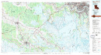
1983 Map of New Orleans
USGS Topo · Published 1983About this map
The Mississippi River defines the industrial and residential heart of this region, winding through a dense corridor of riverfront communities including St. Rose, Destrehan, and Luling. This 1983 survey illustrates the complex relationship between the urban sprawl of New Orleans and Metairie and the surrounding wetlands of south Louisiana. The landscape is dominated by vast water bodies such as Lake Salvador and Lac des Allemands, connected by a network of bayous and the Intracoastal Waterway.
Find a feature on this map
108 named features on this map. Tap any name to fly to it.
Don’t see what you’re looking for? This feature index may not catch every label — zoom into the map to look around manually.
Map Details
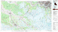
Editions of this 1983 New Orleans Map
2 editions found
Other maps of this area

1891 · Hahnville
USGS Topo · 1:62,500

1891 · Spanish Fort
USGS Topo · 1:62,500

1891 · Pointe a La Hache
USGS Topo · 1:62,500

1891 · New Orleans
USGS Topo · 1:62,500

1892 · Barataria
USGS Topo · 1:62,500

1892 · Lac Des Allemands
USGS Topo · 1:62,500

1892 · Chef Menteur
USGS Topo · 1:62,500

1892 · Mount Airy
USGS Topo · 1:62,500

1892 · Gibson
USGS Topo · 1:62,500

1892 · Bonnet Carre
USGS Topo · 1:62,500