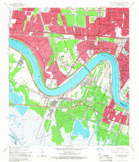
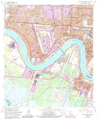
1965 Map of New Orleans West
USGS Topo · Published 1966About this map
The Mississippi River creates a massive, sweeping curve that defines this mid-1960s suburban and industrial landscape west of New Orleans. Rapid residential expansion is evident in the dense street grids of Kenner, Metairie, and Harahan, where numerous educational and religious centers like St Catherine Sch and East Jefferson High Sch served the growing population. The transportation network is remarkably complex, anchored by the Huey P Long Bridge and a dense web of rail lines including the Illinois Central Railroad and Southern Pacific.
Find a feature on this map
70 named features on this map. Tap any name to fly to it.
Don’t see what you’re looking for? This feature index may not catch every label — zoom into the map to look around manually.
Map Details
Editions of this 1965 New Orleans West Map
5 editions found
Other maps of this area

1891 · Hahnville
USGS Topo · 1:62,500

1891 · Spanish Fort
USGS Topo · 1:62,500

1891 · New Orleans
USGS Topo · 1:62,500

1892 · Bonnet Carre
USGS Topo · 1:62,500

1932 · New Orleans NE
USGS Topo · 1:31,680

1932 · New Orleans NW
USGS Topo · 1:31,680

1932 · New Orleans SE
USGS Topo · 1:31,680

1932 · New Orleans SW
USGS Topo · 1:31,680

1932 · Hahnville NE
USGS Topo · 1:31,680

1935 · Luling
USGS Topo · 1:31,680