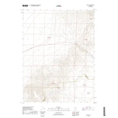
2018 Map of New Pass
USGS Topo · Published 2018About this map
The high desert topography of the New Pass Range and the northern reaches of the Desatoya Mountains dominate this 2018 survey of the Great Basin landscape. The map provides a detailed view of the water resources essential to this arid region, marking the location of New Pass Spring, Abel Spring, and the uniquely named Upper-Lower Jordan Valley Spring. These water sources, along with the drainage of New Pass Cr, historically supported ranching and transit through the high passes between the basin floors. The rugged transition from the mountain slopes down into the Smith Creek Valley is clearly delineated, illustrating the stark relief that characterizes the border between Churchill and Lander Counties. This modern topographic record captures the enduring land patterns of central Nevada, where the sparse placement of named springs and seasonal creeks continues to define the habitable geography.
Find a feature on this map
12 named features on this map. Tap any name to fly to it.
Don’t see what you’re looking for? This feature index may not catch every label — zoom into the map to look around manually.
Map Details
Editions of this 2018 New Pass Map
This is the sole edition of this map. No revisions or reprints were ever made.
Other maps of this area

1955 · Millett
USGS Topo · 1:250,000

1959 · Millett
USGS Topo · 1:250,000

1966 · Edwards Creek Valley
USGS Topo · 1:62,500

1969 · Mount Airy
USGS Topo · 1:24,000

1969 · Mount Airy NW
USGS Topo · 1:24,000

1969 · Emigrant Peak
USGS Topo · 1:24,000

1969 · Carroll Summit NE
USGS Topo · 1:24,000

1969 · Basque Summit
USGS Topo · 1:24,000

1983 · Edwards Creek Valley
USGS Topo · 1:100,000

1985 · Smith Creek Valley
USGS Topo · 1:100,000