
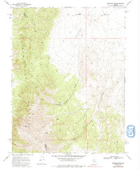
1969 Map of Mount Airy NW
USGS Topo · Published 1971About this map
The New Pass Range dominates this late-1960s landscape, marking the transition into the arid expanse of Antelope Valley. This high-desert terrain is defined by its vital water sources and mineral prospects, where the Churchill Co Lander Co line cuts through the high country. Resource extraction is evident at the Peterson Mine and Santa Rosa Mine, while numerous springs like Little Antelope Spring, Big Antelope Spring, and Water Canyon Spring dictate the movement of both people and livestock across the valley floor.
Find a feature on this map
15 named features on this map. Tap any name to fly to it.
Don’t see what you’re looking for? This feature index may not catch every label — zoom into the map to look around manually.
Map Details
Editions of this 1969 Mount Airy NW Map
2 editions found
Other maps of this area

1955 · Millett
USGS Topo · 1:250,000

1959 · Millett
USGS Topo · 1:250,000

1966 · Shoshone Meadows
USGS Topo · 1:62,500

1966 · Edwards Creek Valley
USGS Topo · 1:62,500

1969 · Gilbert Creek SE
USGS Topo · 1:24,000

1969 · Mount Airy
USGS Topo · 1:24,000

1969 · Gilbert Creek SW
USGS Topo · 1:24,000

1969 · Mount Airy NE
USGS Topo · 1:24,000

1969 · Mount Airy Mesa
USGS Topo · 1:24,000

1983 · Edwards Creek Valley
USGS Topo · 1:100,000