
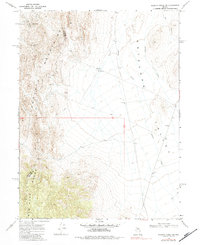
1969 Map of Gilbert Creek SW
USGS Topo · Published 1971About this map
Augusta Mountains and the New Pass Range converge in this high-desert landscape, where the Churchill Co Lander Co line divides the terrain. During the late 1960s, the area remained a site of active resource extraction, centered around the McCoy Mining Camp and the nearby McCoy Mine and Wildhorse Mine. The map reveals a network of Jeep Trails that provided access through the steep contours to various Wells and isolated excavations. To the east, the topography transitions into the relatively level floor of the Antelope Valley, drained by the intermittent flows of Antelope Creek and Gilbert Creek. This survey captures the utilitarian nature of the Nevada desert, where land use was defined by mining, water management at sites like North Well, and the logistics of traversing high-altitude ranges.
Find a feature on this map
15 named features on this map. Tap any name to fly to it.
Don’t see what you’re looking for? This feature index may not catch every label — zoom into the map to look around manually.
Map Details
Editions of this 1969 Gilbert Creek SW Map
2 editions found
Other maps of this area

1955 · Millett
USGS Topo · 1:250,000

1959 · Millett
USGS Topo · 1:250,000

1966 · Shoshone Meadows
USGS Topo · 1:62,500

1966 · Edwards Creek Valley
USGS Topo · 1:62,500

1969 · Gilbert Creek SE
USGS Topo · 1:24,000
1969 · Gilbert Creek NW
USGS Topo · 1:24,000
1969 · Gilbert Creek NE
USGS Topo · 1:24,000

1969 · Mount Airy NW
USGS Topo · 1:24,000

1969 · Mount Airy NE
USGS Topo · 1:24,000

1983 · Edwards Creek Valley
USGS Topo · 1:100,000