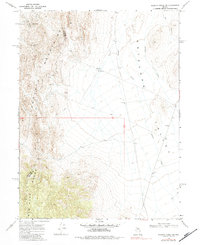
1969 Map of Gilbert Creek SW
USGS Topo · Published 1984About this map
Augusta Mountains and the New Pass Range dominate the western portion of this 1969 field survey, where the rugged peaks descend into the broad expanse of the Antelope Valley. This high-desert landscape in central Nevada is defined by its mid-century mineral extraction, centered on the McCoy Mine and Wildhorse Mine. Near the center of the sheet, the McCoy Mining Camp sits along a network of Jeep Trails that connect these remote operations to essential water sources like North Well. The drainage patterns of Gilbert Creek and Antelope Creek illustrate the typical arid-land hydrology of the region, while the boundary between Churchill and Lander Counties cuts across the mountains, marking a political division in an otherwise unified geologic province.
Find a feature on this map
15 named features on this map. Tap any name to fly to it.
Don’t see what you’re looking for? This feature index may not catch every label — zoom into the map to look around manually.
Map Details
Editions of this 1969 Gilbert Creek SW Map
2 editions found
Other maps of this area

1955 · Millett
USGS Topo · 1:250,000

1959 · Millett
USGS Topo · 1:250,000

1966 · Shoshone Meadows
USGS Topo · 1:62,500

1966 · Edwards Creek Valley
USGS Topo · 1:62,500

1969 · Gilbert Creek SE
USGS Topo · 1:24,000

1969 · Gilbert Creek SW
USGS Topo · 1:24,000
1969 · Gilbert Creek NW
USGS Topo · 1:24,000
1969 · Gilbert Creek NE
USGS Topo · 1:24,000

1969 · Mount Airy NW
USGS Topo · 1:24,000

1969 · Mount Airy NE
USGS Topo · 1:24,000