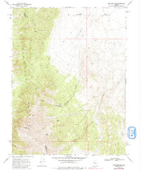
1969 Map of New Pass Peak
USGS Topo · Published 1984About this map
New Pass Peak stands as the primary landmark within the New Pass Range, marking a high point along the boundary shared by Lander and Churchill counties. This 1969 survey, based on 1966 aerial photography, captures a landscape defined by its network of ephemeral water sources and isolated mining operations. Remote trails and jeep tracks provide the only access through the difficult terrain, connecting points of interest like the Santa Rosa Mine and the Peterson Mine.
Find a feature on this map
20 named features on this map. Tap any name to fly to it.
Don’t see what you’re looking for? This feature index may not catch every label — zoom into the map to look around manually.
Map Details
Editions of this 1969 New Pass Peak Map
2 editions found
Other maps of this area

1955 · Millett
USGS Topo · 1:250,000

1959 · Millett
USGS Topo · 1:250,000

1966 · Shoshone Meadows
USGS Topo · 1:62,500

1966 · Edwards Creek Valley
USGS Topo · 1:62,500

1969 · Gilbert Creek SE
USGS Topo · 1:24,000

1969 · Mount Airy
USGS Topo · 1:24,000

1969 · Gilbert Creek SW
USGS Topo · 1:24,000

1969 · Mount Airy NW
USGS Topo · 1:24,000

1969 · Mount Airy NE
USGS Topo · 1:24,000

1969 · Mount Airy Mesa
USGS Topo · 1:24,000