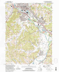
1994 Map of New Philadephia
USGS Topo · Published 1998About this map
The Tuscarawas River winds through this mid-1990s survey, anchoring a region defined by industrial history and the preservation of early settlement roots. In New Philadelphia, the county seat's grid is dense with institutions like the Courthouse and Central Sch, while the Schoenbrunn Village State Memorial marks the site of a 1772 Moravian mission. The landscape reveals the evolution of transport, from the remnants of the Ohio Canal (Abandoned) to the B & O RR tracks and the New Philadelphia Muni Airport. Outside the urban center, the terrain is etched by narrow valleys like Possum Hollow and Sharon Valley. Small mining and residential clusters such as Midvale, Barnhill, and Wainwright are scattered across the quadrangle, interspersed with numerous Strip Mines and several country cemeteries like Ridge Road Cem, documenting the area's rural and extraction-based economy.
Find a feature on this map
70 named features on this map. Tap any name to fly to it.
Don’t see what you’re looking for? This feature index may not catch every label — zoom into the map to look around manually.
Map Details
Editions of this 1994 New Philadephia Map
This is the sole edition of this map. No revisions or reprints were ever made.
Other maps of this area

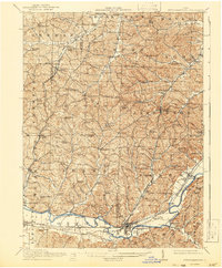
1909 · Uhrichsville
USGS Topo · 1:62,500

1911 · Uhrichsville
USGS Topo · 1:62,500

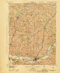
1911 · Newcomerstown
USGS Topo · 1:62,500

1912 · Dover
USGS Topo · 1:62,500
1913 · Newcomerstown
USGS Topo · 1:62,500

1914 · Navarre
USGS Topo · 1:62,500
1943 · Newcomerstown
USGS Topo · 1:62,500

1944 · Navarre
USGS Topo · 1:62,500

1944 · Dover
USGS Topo · 1:62,500

1951 · Canton
USGS Topo · 1:250,000