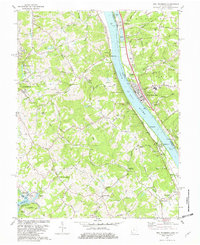
1981 Map of New Richmond
USGS Topo · Published 1982About this map
The Ohio River valley serves as a bustling corridor between Ohio and Kentucky in this early 1980s revision, anchored by the riverfront town of New Richmond. The landscape is a mix of established riparian communities and the deeply dissected uplands of Campbell County. Along the Kentucky shore, the Chesapeake and Ohio railroad tracks follow the river's curve, passing through Oneonta and the New Richmond Station. Local history is preserved in numerous upland cemeteries like Watkins Cem and Greenmound Cem, while the interior shows the enduring footprint of small settlements such as Persimmon Grove and Carthage.
Find a feature on this map
72 named features on this map. Tap any name to fly to it.
Don’t see what you’re looking for? This feature index may not catch every label — zoom into the map to look around manually.
Map Details
Editions of this 1981 New Richmond Map
2 editions found
Other maps of this area

1898 · East Cincinnati
USGS Topo · 1:62,500

1914 · East Cincinnati
USGS Topo · 1:62,500

1914 · Batavia
USGS Topo · 1:48,000

1916 · Batavia
USGS Topo · 1:62,500

1929 · Alexandria
USGS Topo · 1:48,000

1931 · Felicity
USGS Topo · 1:62,500

1936 · Alexandria
USGS Topo · 1:62,500

1952 · Newport
USGS Topo · 1:24,000

1953 · Laurel
USGS Topo · 1:24,000

1953 · Withamsville
USGS Topo · 1:24,000