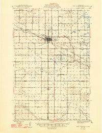
1948 Map of New Rockford
USGS Topo · Published 1948About this map
New Rockford serves as the central hub of this mid-century prairie landscape, situated at the confluence of several significant North Dakota townships including Munster, Rosefield, and Superior. This post-war era map highlights the vital role of transportation in the region, with the Northern Pacific and Great Northern railroads crossing the terrain near the Great Northern River. Educational landmarks like the Rockford Consolidated Sch and Estabrook Sch are scattered throughout the rural townships, reflecting the community structure of the time.
Find a feature on this map
30 named features on this map. Tap any name to fly to it.
Don’t see what you’re looking for? This feature index may not catch every label — zoom into the map to look around manually.
Map Details
Editions of this 1948 New Rockford Map
2 editions found
Other maps of this area

1900 · Pingree
USGS Topo · 1:125,000

1928 · Tokio
USGS Topo · 1:62,500

1931 · Oberon
USGS Topo · 1:62,500

1931 · Tokio
USGS Topo · 1:62,500

1932 · Flora
USGS Topo · 1:62,500

1944 · Brantford
USGS Topo · 1:62,500

1946 · Brantford
USGS Topo · 1:62,500

1948 · New Rockford
USGS Topo · 1:62,500

1948 · Cathay
USGS Topo · 1:62,500

1948 · Carrington
USGS Topo · 1:62,500