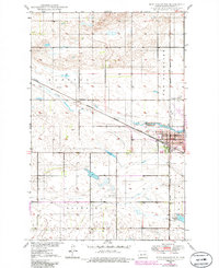
1950 Map of New Rockford
USGS Topo · Published 1986About this map
New Rockford serves as the focal point of this mid-century survey, situated along the winding banks of the James River. The landscape is defined by its agricultural and transportation utility, with the Burlington Northern railroad cutting a diagonal path through the prairie. Local civic life is anchored by landmarks such as the Po, Hospital, and the Country Club on the outskirts of town.
Find a feature on this map
17 named features on this map. Tap any name to fly to it.
Don’t see what you’re looking for? This feature index may not catch every label — zoom into the map to look around manually.
Map Details
Editions of this 1950 New Rockford Map
3 editions found
Other maps of this area

1931 · Oberon
USGS Topo · 1:62,500

1932 · Flora
USGS Topo · 1:62,500

1948 · New Rockford
USGS Topo · 1:62,500

1948 · Cathay
USGS Topo · 1:62,500

1949 · Cathay SE
USGS Topo · 1:24,000

1949 · Munster
USGS Topo · 1:24,000

1950 · New Rockford
USGS Topo · 1:24,000

1950 · New Rockford NE
USGS Topo · 1:24,000

1950 · Oberon SW
USGS Topo · 1:24,000

1950 · Sheyenne
USGS Topo · 1:24,000