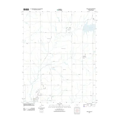
2012 Map of New Salem
USGS Topo · Published 2012About this map
The agrarian landscape of Cowley County is defined by a series of petroleum developments and the wandering path of Timber Cr. Central to this area are the small settlements of Floral and New Salem, which serve as anchors for a grid of country roads. The local economy and history are deeply tied to the subsurface, evidenced by the extensive Deichman Oil Field, Hittle Oil Field, Wilmot Floral Oil Field, and Biddle Oil Field which dot the sections.
Find a feature on this map
59 named features on this map. Tap any name to fly to it.
Don’t see what you’re looking for? This feature index may not catch every label — zoom into the map to look around manually.
Map Details
Editions of this 2012 New Salem Map
This is the sole edition of this map. No revisions or reprints were ever made.
Other maps of this area

1889 · Burden
USGS Topo · 1:125,000

1890 · Wellington
USGS Topo · 1:125,000

1955 · Udall
USGS Topo · 1:24,000

1955 · Wichita
USGS Topo · 1:250,000

1958 · Wichita
USGS Topo · 1:250,000

1964 · Burden
USGS Topo · 1:24,000
1964 · Atlanta
USGS Topo · 1:24,000

1965 · Eaton
USGS Topo · 1:24,000

1965 · Winfield
USGS Topo · 1:24,000
1965 · Wilmot
USGS Topo · 1:24,000