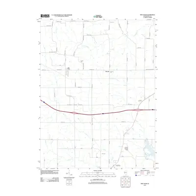
2012 Map of New Salem
USGS Topo · Published 2012About this map
New Salem and Maysville serve as the primary nodes of settlement in this part of Pike County, where the landscape is defined by the winding paths of Bay Creek and Panther Creek. The terrain reveals a transition from traditional rural townships to modern infrastructure, exemplified by the Pittsfield Penstone Municipal Airport and the expansion of Lake Pittsfield in the southeast. This survey is particularly useful for genealogists, as it meticulously identifies numerous small burial grounds that dot the countryside, including Hinman Cemetery, Swiggett Cemetery, and Simpkins Brown Cemetery. These sites are often the only remaining markers of the early families who farmed the land between South Fork McKee Creek and Blue Creek. The road network shows a transition from local township routes like Baylis Black Top Road to modern thoroughfares that bypass the older village centers.
Find a feature on this map
71 named features on this map. Tap any name to fly to it.
Don’t see what you’re looking for? This feature index may not catch every label — zoom into the map to look around manually.
Map Details
Editions of this 2012 New Salem Map
This is the sole edition of this map. No revisions or reprints were ever made.
Other maps of this area

1924 · Griggsville
USGS Topo · 1:62,500

1926 · Griggsville
USGS Topo · 1:62,500

1926 · Pittsfield
USGS Topo · 1:62,500

1926 · Mt Sterling
USGS Topo · 1:62,500

1928 · Meredosia
USGS Topo · 1:62,500

1929 · Mt Sterling
USGS Topo · 1:62,500

1931 · Meredosia
USGS Topo · 1:62,500

1948 · Quincy
USGS Topo · 1:250,000

1956 · Quincy
USGS Topo · 1:250,000

1975 · Pittsfield SE
USGS Topo · 1:24,000