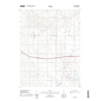
2018 Map of New Salem
USGS Topo · Published 2018About this map
Pittsfield serves as a primary hub in this portion of Pike County, where the landscape transitions from the residential streets of the city to the fertile agricultural plains. The area is defined by a dense network of township and county roads, such as Baylis Rd and Co Hwy 2, which connect the smaller settlements of New Salem and Maysville. Numerous family and community burial grounds, including Gray Cem and Simpkins-Brown Cem, are scattered across the terrain, offering significant touchpoints for genealogical research. The topography is shaped by several watercourses like Blue Cr and Panther Cr, which drain into the larger basin near Lake Pittsfield. To the southeast, the Pittsfield Penstone Municipal Airport stands as a modern landmark, contrasting with the longstanding rural character of the surrounding townships.
Find a feature on this map
50 named features on this map. Tap any name to fly to it.
Don’t see what you’re looking for? This feature index may not catch every label — zoom into the map to look around manually.
Map Details
Editions of this 2018 New Salem Map
This is the sole edition of this map. No revisions or reprints were ever made.
Other maps of this area

1924 · Griggsville
USGS Topo · 1:62,500

1926 · Griggsville
USGS Topo · 1:62,500

1926 · Pittsfield
USGS Topo · 1:62,500

1926 · Mt Sterling
USGS Topo · 1:62,500

1928 · Meredosia
USGS Topo · 1:62,500

1929 · Mt Sterling
USGS Topo · 1:62,500

1931 · Meredosia
USGS Topo · 1:62,500

1948 · Quincy
USGS Topo · 1:250,000

1956 · Quincy
USGS Topo · 1:250,000
1975 · Pittsfield SE
USGS Topo · 1:24,000