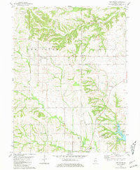
1981 Map of New Salem
USGS Topo · Published 1981About this map
The Norfolk and Western railroad corridor anchors the landscape of central Pike County, connecting the small settlements of New Salem and Maysville with the outlying Maysville Station. The terrain is defined by the drainage patterns of South Fork McKee Creek, Bay Creek, and Blue Creek, which carve through the till plains. An active Gas Field in the northwest corner and the presence of the Pittsfield-Penstone Airfield suggest an area shaped by both energy extraction and regional transit at the start of the 1980s.
Find a feature on this map
29 named features on this map. Tap any name to fly to it.
Don’t see what you’re looking for? This feature index may not catch every label — zoom into the map to look around manually.
Map Details
Editions of this 1981 New Salem Map
This is the sole edition of this map. No revisions or reprints were ever made.
Other maps of this area

1924 · Griggsville
USGS Topo · 1:62,500

1926 · Griggsville
USGS Topo · 1:62,500

1926 · Pittsfield
USGS Topo · 1:62,500

1926 · Mt Sterling
USGS Topo · 1:62,500

1928 · Meredosia
USGS Topo · 1:62,500

1929 · Mt Sterling
USGS Topo · 1:62,500

1931 · Meredosia
USGS Topo · 1:62,500

1948 · Quincy
USGS Topo · 1:250,000

1956 · Quincy
USGS Topo · 1:250,000
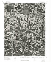
1975 · Pittsfield SE
USGS Topo · 1:24,000